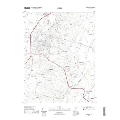
2019 Map of Martinsburg
USGS Topo · Published 2019About this map
Martinsburg and its surrounding Berkeley County landscape are defined by a complex network of springs and limestone-influenced drainage. The area's deep history is legible through numerous family and denominational burial grounds, ranging from the Providence Quaker Cem and Saint Josephs Cem to the Old Norbourne Cem. Small outlying communities like Files Crossroad and Grubbs Corner maintain their distinct identities even as the regional footprint of the Eastern WV Regional Airport/Shepherd Field expands.
Find a feature on this map
63 named features on this map. Tap any name to fly to it.
Don’t see what you’re looking for? This feature index may not catch every label — zoom into the map to look around manually.
Map Details
Editions of this 2019 Martinsburg Map
This is the sole edition of this map. No revisions or reprints were ever made.
Other maps of this area

1884 · Harpers Ferry
USGS Topo · 1:125,000

1891 · Harpers Ferry
USGS Topo · 1:125,000

1893 · Harpers Ferry
USGS Topo · 1:125,000

1894 · Winchester
USGS Topo · 1:125,000

1899 · Hancock
USGS Topo · 1:62,500

1901 · Hancock
USGS Topo · 1:62,500

1912 · Williamsport
USGS Topo · 1:62,500

1914 · Martinsburg
USGS Topo · 1:48,000

1914 · Gerrardstown
USGS Topo · 1:48,000

1916 · Gerrardstown
USGS Topo · 1:62,500