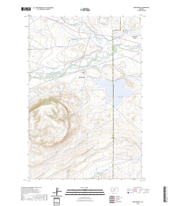
2024 Map of Martinsdale
USGS Topo · Published 2024About this map
The confluence of the North Fork Musselshell River and the South Fork Musselshell River anchors this Central Montana landscape, where the Meagher and Wheatland county line intersects the valley. The settlement of Martinsdale sits just west of the Martinsdale Reservoir, a significant water feature that dominates the eastern portion of the quadrangle. North of the main settlement, the Martinsdale Colony and the nearby Gauglerville Cem provide critical points of interest for genealogists and local historians tracking family roots in the area. To the south, the terrain rises sharply toward Gordon Butte, creating a dramatic elevation contrast with the river bottoms where Gillis Creek and Little Elk Creek contribute to the watershed. The map records a rural network of local routes including Lake Access Rd and Gauglerville Access Rd, reflecting the community's reliance on both the ranching economy and the water resources of the Musselshell.
Find a feature on this map
23 named features on this map. Tap any name to fly to it.
Don’t see what you’re looking for? This feature index may not catch every label — zoom into the map to look around manually.
Map Details
Editions of this 2024 Martinsdale Map
This is the sole edition of this map. No revisions or reprints were ever made.
Other maps of this area

1886 · Little Belt Mts.
USGS Topo · 1:250,000

1894 · Little Belt Mts.
USGS Topo · 1:250,000

1897 · Little Belt Mts.
USGS Topo · 1:250,000

1898 · Little Belt Mts.
USGS Topo · 1:250,000

1902 · Little Belt Mts.
USGS Topo · 1:250,000

1948 · White Sulphur Springs
USGS Topo · 1:250,000

1958 · White Sulphur Springs
USGS Topo · 1:250,000

1961 · White Sulphur Springs
USGS Topo · 1:250,000

1965 · White Sulphur Springs
USGS Topo · 1:250,000
1972 · Mud Creek
USGS Topo · 1:24,000