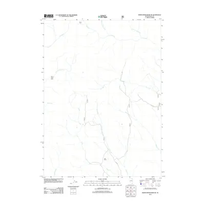
2012 Map of Marys River Basin NE
USGS Topo · Published 2012About this map
Marys River Basin defines this high-desert drainage system in Elko County during the early 21st century. The landscape is characterized by a dense network of seasonal and perennial waterways that converge toward the Marys River, including Sun Creek, Wildcat Creek, and the uniquely named T Creek. These waters flow through distinct topographical depressions such as Pete Basin and the broader basin floor. Human presence is limited to remote outposts like Smiths Camp in the northern reaches and a sparse network of access routes including NFB 309 Rd. The intricate hydrography shown here, from the North Fork Camp Creek to the East Fork Marys River, illustrates the complex water-management reality of northeastern Nevada's high plains, where even minor drainages like Draw Creek and Chimney Creek serve as critical markers in an otherwise expansive terrain.
Find a feature on this map
18 named features on this map. Tap any name to fly to it.
Don’t see what you’re looking for? This feature index may not catch every label — zoom into the map to look around manually.
Map Details
Editions of this 2012 Marys River Basin NE Map
This is the sole edition of this map. No revisions or reprints were ever made.
Other maps of this area

1943 · Jarbidge
USGS Topo · 1:62,500

1945 · Jarbidge
USGS Topo · 1:62,500

1955 · Wells
USGS Topo · 1:250,000

1957 · Elk Mountain
USGS Topo · 1:62,500

1958 · Wells
USGS Topo · 1:250,000

1961 · Wells
USGS Topo · 1:250,000

1968 · Charleston Reservoir
USGS Topo · 1:24,000

1968 · Marys River Basin NE
USGS Topo · 1:24,000

1968 · Marys River Basin SE
USGS Topo · 1:24,000

1968 · Hot Creek
USGS Topo · 1:24,000