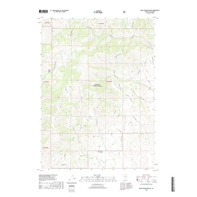
2018 Map of Marys River Basin NE
USGS Topo · Published 2018About this map
Humboldt National Forest encompasses the high country of this Elko County interior, where the Marys River Basin and Pete Basin provide the defining structure for the landscape. The hydrography here is dominated by the headwaters of several major systems, including the Marys River and its E Fork Marys River, as well as the E Fork Jarbidge River which drains to the north. A complex network of Forest Service roads and spurs, such as Wildcat to Camp Creek and the Sun Loop Sun Loop, provides access through the terrain. The map documents numerous named drainages including Camp Creek, Basin Cr, and Williams Cr, alongside many specialized forest tracks like the Anderson and Pete spurs. The survey reveals a landscape primarily dedicated to watershed protection and resource management, characterized by a high density of named creeks and draws.
Find a feature on this map
56 named features on this map. Tap any name to fly to it.
Don’t see what you’re looking for? This feature index may not catch every label — zoom into the map to look around manually.
Map Details
Editions of this 2018 Marys River Basin NE Map
This is the sole edition of this map. No revisions or reprints were ever made.
Other maps of this area

1943 · Jarbidge
USGS Topo · 1:62,500

1945 · Jarbidge
USGS Topo · 1:62,500

1955 · Wells
USGS Topo · 1:250,000

1957 · Elk Mountain
USGS Topo · 1:62,500

1958 · Wells
USGS Topo · 1:250,000

1961 · Wells
USGS Topo · 1:250,000

1968 · Charleston Reservoir
USGS Topo · 1:24,000

1968 · Marys River Basin NE
USGS Topo · 1:24,000

1968 · Marys River Basin SE
USGS Topo · 1:24,000

1968 · Hot Creek
USGS Topo · 1:24,000