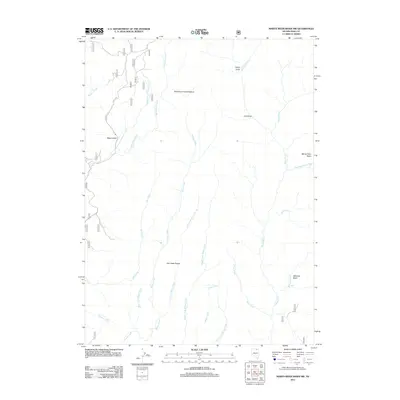
2012 Map of Marys River Basin NW
USGS Topo · Published 2012About this map
Marys River Basin in Elko County defines a landscape of complex drainage systems and high-desert grazing lands. The hydrology of the area is dominated by the Marys River and its numerous tributaries, including the West Fork Marys River and the East Fork Marys River. The terrain transitions from the elevations of the Fox Creek Range down into expansive flats like the Seventysix Creek Pasture. Local landmarks such as Mud Spring and Major Gulch suggest a history of seasonal water management and livestock movement. A network of Forest Service and local routes, including 066 and 1308, provides access to these isolated basins. Researchers can trace the varied forks of Willow Creek, including the Little Fork Willow Creek and Middle Fork Willow Creek, which reveal the intricate natural irrigation of this corner of Nevada.
Find a feature on this map
41 named features on this map. Tap any name to fly to it.
Don’t see what you’re looking for? This feature index may not catch every label — zoom into the map to look around manually.
Map Details
Editions of this 2012 Marys River Basin NW Map
This is the sole edition of this map. No revisions or reprints were ever made.
Other maps of this area

1935 · Charleston
USGS Topo · 1:48,000

1936 · Rowland
USGS Topo · 1:48,000

1940 · Rowland
USGS Topo · 1:62,500

1942 · Mt. Velma
USGS Topo · 1:62,500

1943 · Jarbidge
USGS Topo · 1:62,500

1945 · Jarbidge
USGS Topo · 1:62,500

1955 · Wells
USGS Topo · 1:250,000

1958 · Wells
USGS Topo · 1:250,000

1961 · Wells
USGS Topo · 1:250,000

1968 · Charleston Reservoir
USGS Topo · 1:24,000