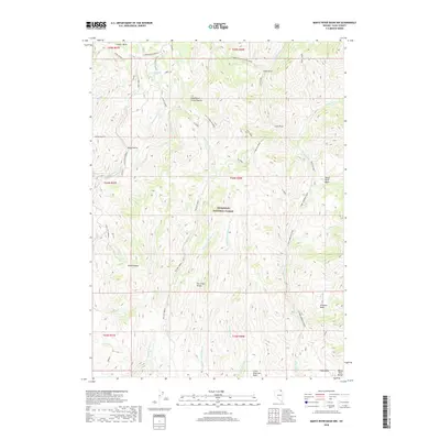
2018 Map of Marys River Basin NW
USGS Topo · Published 2018About this map
The Humboldt National Forest dominates this high-altitude corner of Elko County, where the Fox Creek Range and the Marys River Range define the watershed. This landscape is a complex network of high-desert drainage basins, most notably the Marys River Basin and the Williams Basin. The hydrology is particularly intricate, featuring the Marys River alongside the E Fork Jarbidge River and multiple forks of Willow Cr. Cattle ranching history is suggested by labels like the Seventysix Creek Pasture and several named corrals. Historically significant routes like the Charleston-Jarbidge road and the trail from W Marys River to Camp Draw provide a look at the primitive infrastructure used to navigate this terrain between Copper Basin and the deep Miles Canyon.
Find a feature on this map
42 named features on this map. Tap any name to fly to it.
Don’t see what you’re looking for? This feature index may not catch every label — zoom into the map to look around manually.
Map Details
Editions of this 2018 Marys River Basin NW Map
This is the sole edition of this map. No revisions or reprints were ever made.
Other maps of this area

1935 · Charleston
USGS Topo · 1:48,000

1936 · Rowland
USGS Topo · 1:48,000

1940 · Rowland
USGS Topo · 1:62,500

1942 · Mt. Velma
USGS Topo · 1:62,500

1943 · Jarbidge
USGS Topo · 1:62,500

1945 · Jarbidge
USGS Topo · 1:62,500

1955 · Wells
USGS Topo · 1:250,000

1958 · Wells
USGS Topo · 1:250,000

1961 · Wells
USGS Topo · 1:250,000

1968 · Charleston Reservoir
USGS Topo · 1:24,000