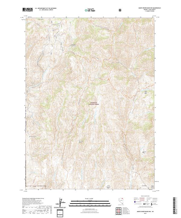
2021 Map of Marys River Basin NW
USGS Topo · Published 2021About this map
The Humboldt National Forest encompasses much of this high-elevation landscape, where the Fox Creek Range rises above a complex system of drainage basins. The map documents a network of seasonal watercourses and springs, including Mud Spring and the headwaters of the Marys River. The terrain is characterized by large, named depressions like Chalk Basin, Williams Basin, and Little Reservoir Basin, which serve as natural catchments for the surrounding peaks. Historical land use is evident in named grazing areas such as the Seventysix Creek Pasture. A series of pack trails and forest tracks, including the Charleston-Jarbidge and Major Gulch Charleston-Jarbidge, navigate the steep ascents through Miles Canyon and the Copper Basin, illustrating the importance of these routes for ranching and forest management in this corner of Elko County.
Find a feature on this map
51 named features on this map. Tap any name to fly to it.
Don’t see what you’re looking for? This feature index may not catch every label — zoom into the map to look around manually.
Map Details
Editions of this 2021 Marys River Basin NW Map
This is the sole edition of this map. No revisions or reprints were ever made.
Other maps of this area

1935 · Charleston
USGS Topo · 1:48,000

1936 · Rowland
USGS Topo · 1:48,000

1940 · Rowland
USGS Topo · 1:62,500

1942 · Mt. Velma
USGS Topo · 1:62,500

1943 · Jarbidge
USGS Topo · 1:62,500

1945 · Jarbidge
USGS Topo · 1:62,500

1955 · Wells
USGS Topo · 1:250,000

1958 · Wells
USGS Topo · 1:250,000

1961 · Wells
USGS Topo · 1:250,000

1968 · Charleston Reservoir
USGS Topo · 1:24,000