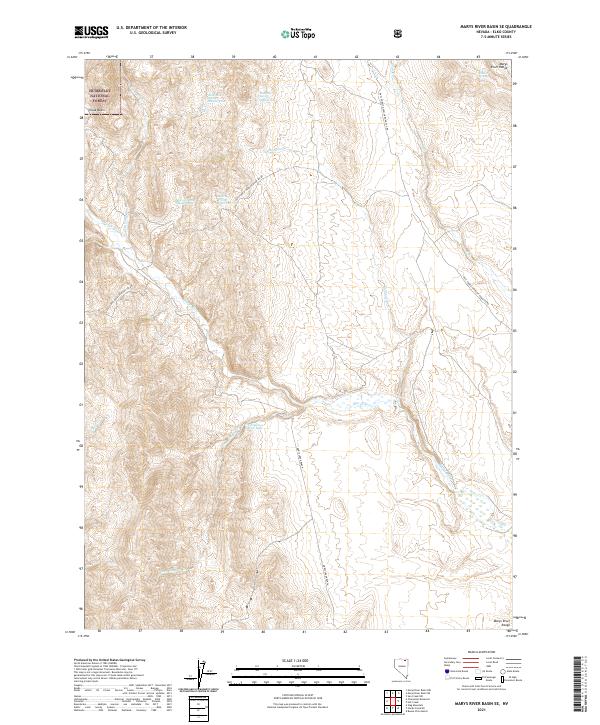
2021 Map of Marys River Basin SE
USGS Topo · Published 2021About this map
Marys Creek Ranch occupies a central position within this remote Nevada landscape, where the Marys River winds through the valley floor. To the east, the steep elevations of the Marys River Range dominate the horizon, while the northwest corner includes a portion of the Humboldt National Forest at Chalk Basin. The water distribution across this high-desert terrain is marked by numerous named springs, including Anderson Spring Number One and Union Spring Number Eight, suggesting a complex system of seasonal water management for local ranching.
Find a feature on this map
24 named features on this map. Tap any name to fly to it.
Don’t see what you’re looking for? This feature index may not catch every label — zoom into the map to look around manually.
Map Details
Editions of this 2021 Marys River Basin SE Map
This is the sole edition of this map. No revisions or reprints were ever made.
Other maps of this area

1955 · Wells
USGS Topo · 1:250,000

1958 · Wells
USGS Topo · 1:250,000

1961 · Wells
USGS Topo · 1:250,000

1967 · Stag Mountain
USGS Topo · 1:24,000

1967 · Buena Vista Ranch
USGS Topo · 1:24,000

1967 · Hanks Creek NE
USGS Topo · 1:24,000

1968 · Charleston Reservoir
USGS Topo · 1:24,000

1968 · Marys River Basin NE
USGS Topo · 1:24,000

1968 · Marys River Basin SE
USGS Topo · 1:24,000

1968 · Hot Creek
USGS Topo · 1:24,000