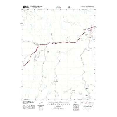
2011 Map of Marysvale Canyon
USGS Topo · Published 2011About this map
Marysvale Canyon and the surrounding peaks of the Tushar Range dominate this 2011 survey, showing a landscape defined by steep drainages and isolated mining claims. The Sevier River flows through the eastern corridor, anchoring a string of small settlements including Sevier, Belknap, and Hoovers. This area has long been a crossroads for transit and extraction, evidenced here by the presence of the BW and H Mine and the Yellow Cougar Mine located near Hoover Peak. The topography is marked by significant elevation changes, from the depths of Clear Creek Canyon to the heights of Sargent Mountain. Recreational and natural landmarks are prominent throughout the canyon system, including the distinctive Big Rock Candy Mountain and the Castle Rock Campground, while high-altitude water bodies like Willow Lake, Twin Lake, and Hidden Lake dot the western interior.
Find a feature on this map
40 named features on this map. Tap any name to fly to it.
Don’t see what you’re looking for? This feature index may not catch every label — zoom into the map to look around manually.
Map Details
Editions of this 2011 Marysvale Canyon Map
This is the sole edition of this map. No revisions or reprints were ever made.
Other maps of this area

1885 · Beaver
USGS Topo · 1:250,000

1932 · Sevier
USGS Topo · 1:62,500

1935 · Sevier
USGS Topo · 1:62,500

1937 · Delano Peak
USGS Topo · 1:48,000

1940 · Monroe
USGS Topo · 1:62,500

1943 · Delano Peak
USGS Topo · 1:62,500

1944 · Monroe
USGS Topo · 1:62,500

1945 · Marysvale
USGS Topo · 1:62,500

1947 · Marysvale
USGS Topo · 1:62,500

1953 · Richfield
USGS Topo · 1:250,000