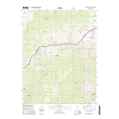
2017 Map of Marysvale Canyon
USGS Topo · Published 2017About this map
Big Rock Candy Mtn serves as a colorful focal point in this landscape of the Tushar Mountains, where the Sevier River carves through the dramatic Marysvale Canyon. This 2017 survey details the complex terrain of the Fishlake National Forest and Fremont State Park, revealing a network of historical transit routes and water sources. To the south, the settlements of Belknap and Pittsburg sit near the county line, while the northern reaches include the small community of Sevier. The map highlights the high-elevation geography of the region, from Hoover Peak and Sargent Mtn to the secluded waters of Willow Lake and Hidden Lake. Traces of local history are etched into the nomenclature of the hollows and flats, such as Graveyard Hollow and Joseph Flats, while the presence of the Paiute (D-1) trail system underscores the area's long-standing importance for travel and resource access.
Find a feature on this map
66 named features on this map. Tap any name to fly to it.
Don’t see what you’re looking for? This feature index may not catch every label — zoom into the map to look around manually.
Map Details
Editions of this 2017 Marysvale Canyon Map
This is the sole edition of this map. No revisions or reprints were ever made.
Other maps of this area

1885 · Beaver
USGS Topo · 1:250,000

1932 · Sevier
USGS Topo · 1:62,500

1935 · Sevier
USGS Topo · 1:62,500

1937 · Delano Peak
USGS Topo · 1:48,000

1940 · Monroe
USGS Topo · 1:62,500

1943 · Delano Peak
USGS Topo · 1:62,500

1944 · Monroe
USGS Topo · 1:62,500

1945 · Marysvale
USGS Topo · 1:62,500

1947 · Marysvale
USGS Topo · 1:62,500

1953 · Richfield
USGS Topo · 1:250,000