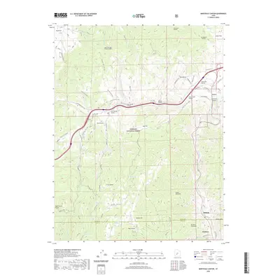
2020 Map of Marysvale Canyon
USGS Topo · Published 2020About this map
Fishlake National Forest dominates this section of the Tushar Mountains, where the Sevier River carves a deep path through Clear Creek Canyon. The terrain is defined by dramatic elevation shifts and a network of canyons including Sam Stowe Canyon and Skinner Canyon. Cultural history is anchored by Fremont State Park and the Fremont Museum Loop, preserving the legacy of early inhabitants near the confluence of Clear Creek and the river.
Find a feature on this map
107 named features on this map. Tap any name to fly to it.
Don’t see what you’re looking for? This feature index may not catch every label — zoom into the map to look around manually.
Map Details
Editions of this 2020 Marysvale Canyon Map
This is the sole edition of this map. No revisions or reprints were ever made.
Other maps of this area

1885 · Beaver
USGS Topo · 1:250,000

1932 · Sevier
USGS Topo · 1:62,500

1935 · Sevier
USGS Topo · 1:62,500

1937 · Delano Peak
USGS Topo · 1:48,000

1940 · Monroe
USGS Topo · 1:62,500

1943 · Delano Peak
USGS Topo · 1:62,500

1944 · Monroe
USGS Topo · 1:62,500

1945 · Marysvale
USGS Topo · 1:62,500

1947 · Marysvale
USGS Topo · 1:62,500

1953 · Richfield
USGS Topo · 1:250,000