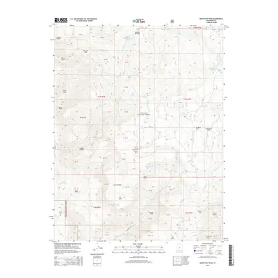
2014 Map of Marysvale Peak
USGS Topo · Published 2014About this map
Marysvale Peak and its surrounding high-altitude terrain define this 2014 survey of the Fishlake National Forest. The landscape is a complex network of hydrological features, from the large Manning Meadows Reservoir to smaller mountain water sources like White Ledge Spring and Rock Spring. These water bodies are connected by numerous drainages, including Langdon Cr and the various forks of Box Cr. The area is marked by significant topographic variation, with high points such as Bean Hill and extensive flats like Big Table and Little Meadows. Transport through this section of the forest is supported by several designated routes, such as Dry Creek Rd and BLM Rd 6241, providing access to the reservoirs and landmarks like Miners Ridge and Windy Ridge.
Find a feature on this map
63 named features on this map. Tap any name to fly to it.
Don’t see what you’re looking for? This feature index may not catch every label — zoom into the map to look around manually.
Map Details
Editions of this 2014 Marysvale Peak Map
This is the sole edition of this map. No revisions or reprints were ever made.
Other maps of this area

1885 · Beaver
USGS Topo · 1:250,000

1885 · Fish Lake
USGS Topo · 1:250,000

1896 · Fish Lake
USGS Topo · 1:250,000

1940 · Monroe
USGS Topo · 1:62,500

1944 · Monroe
USGS Topo · 1:62,500

1945 · Marysvale
USGS Topo · 1:62,500

1947 · Marysvale
USGS Topo · 1:62,500

1953 · Richfield
USGS Topo · 1:250,000

1956 · Salina
USGS Topo · 1:250,000

1958 · Richfield
USGS Topo · 1:250,000