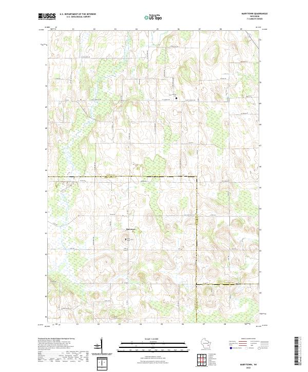
2022 Map of Marytown
USGS Topo · Published 2022About this map
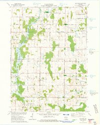
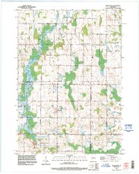
Marytown sits at the heart of this agricultural landscape where Calumet, Fond du Lac, and Sheboygan counties converge. The surrounding countryside is defined by a rigorous grid of section lines and rural routes like Kiel Rd and Old State Hwy 149, reflecting a long history of dairy farming and small-town commerce in east-central Wisconsin. The South Branch Manitowoc River meanders through the northern sections of the quadrangle, providing a natural break in the orderly arrangement of fields.
Find a feature on this map
50 named features on this map. Tap any name to fly to it.
Don’t see what you’re looking for? This feature index may not catch every label — zoom into the map to look around manually.
Map Details
Editions of this 2022 Marytown Map
This is the sole edition of this map. No revisions or reprints were ever made.
Historical Maps of Brothertown Through Time
7 maps found