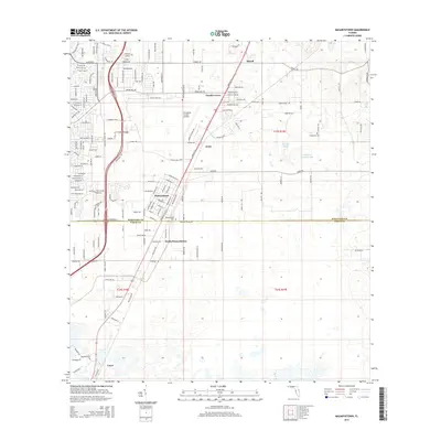
2015 Map of Masaryktown
USGS Topo · Published 2015About this map
Masaryktown serves as the focal point of this coastal-plain landscape along the boundary of Hernando and Pasco counties. The map documents a transition from established agricultural areas like Squirrel Prairie to modern infrastructure, centered around the Hernando County Airport and the north-south corridor of CSX Transportation. Smaller settlements including Garden Grove, Ayers, and Powell dot the northern half of the sheet, while Loyce is situated at the southern edge. Local history and genealogy are preserved through markers such as the Masaryktown Cem and McGeachy Cem. The physical landscape is characterized by scattered wetlands and depressions typical of the region, notably Cypress Pond and Squirrel Prairie Lake, alongside a developing road network that includes Spring Hill Dr and Powell Rd.
Find a feature on this map
29 named features on this map. Tap any name to fly to it.
Don’t see what you’re looking for? This feature index may not catch every label — zoom into the map to look around manually.
Map Details
Editions of this 2015 Masaryktown Map
This is the sole edition of this map. No revisions or reprints were ever made.
Other maps of this area

1954 · Spring Lake
USGS Topo · 1:24,000

1954 · Ehren
USGS Topo · 1:24,000

1954 · San Antonio
USGS Topo · 1:24,000

1954 · Fivay
USGS Topo · 1:24,000

1954 · Brooksville
USGS Topo · 1:24,000

1954 · Masaryktown
USGS Topo · 1:24,000

1954 · Brooksville SE
USGS Topo · 1:24,000

1954 · Weekiwachee Springs
USGS Topo · 1:24,000

1954 · Port Richey NE
USGS Topo · 1:24,000

1955 · Plant City
USGS Topo · 1:250,000