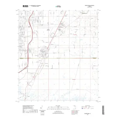
2018 Map of Masaryktown
USGS Topo · Published 2018About this map
Masaryktown serves as the focal point of this modern survey of the Hernando and Pasco County border, showcasing a landscape defined by its agricultural heritage and expanding infrastructure. The community's unique street names, such as Stefanik St, Mudron St, and Hviezdoslav St, reflect its historical roots as a Czech and Slovak farming colony. This cultural imprint remains visible alongside more recent developments like the Brooksville-Tampa Bay Regional Airport and the residential corridors of Garden Grove.
Find a feature on this map
57 named features on this map. Tap any name to fly to it.
Don’t see what you’re looking for? This feature index may not catch every label — zoom into the map to look around manually.
Map Details
Editions of this 2018 Masaryktown Map
This is the sole edition of this map. No revisions or reprints were ever made.
Other maps of this area

1954 · Spring Lake
USGS Topo · 1:24,000

1954 · Ehren
USGS Topo · 1:24,000

1954 · San Antonio
USGS Topo · 1:24,000

1954 · Fivay
USGS Topo · 1:24,000

1954 · Brooksville
USGS Topo · 1:24,000

1954 · Masaryktown
USGS Topo · 1:24,000

1954 · Brooksville SE
USGS Topo · 1:24,000

1954 · Weekiwachee Springs
USGS Topo · 1:24,000

1954 · Port Richey NE
USGS Topo · 1:24,000

1955 · Plant City
USGS Topo · 1:250,000