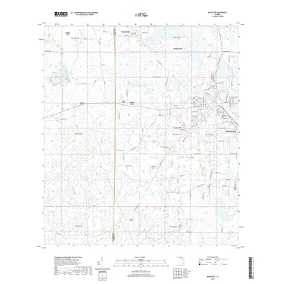
2018 Map of Mascotte
USGS Topo · Published 2018About this map
The boundary between Sumter and Lake Counties bisects a landscape defined by citrus-era settlements and intricate water systems in Central Florida. Mascotte and Groveland stand as primary hubs, surrounded by historic residential and agricultural pockets like Tuscannoga, Mabel, and Center Hill. The terrain transitions from the low-lying Head Swamp and Bayroot Slough in the south to the higher elevations of Slones Ridge.
Find a feature on this map
123 named features on this map. Tap any name to fly to it.
Don’t see what you’re looking for? This feature index may not catch every label — zoom into the map to look around manually.
Map Details
Editions of this 2018 Mascotte Map
This is the sole edition of this map. No revisions or reprints were ever made.
Other maps of this area

1955 · Plant City
USGS Topo · 1:250,000

1955 · Orlando
USGS Topo · 1:250,000

1957 · Orlando
USGS Topo · 1:250,000

1958 · Orlando
USGS Topo · 1:250,000

1958 · Plant City
USGS Topo · 1:250,000

1958 · Webster
USGS Topo · 1:24,000

1958 · Bushnell
USGS Topo · 1:24,000

1959 · Plant City
USGS Topo · 1:250,000

1959 · Lake Nellie
USGS Topo · 1:24,000
1960 · Bay Lake
USGS Topo · 1:24,000