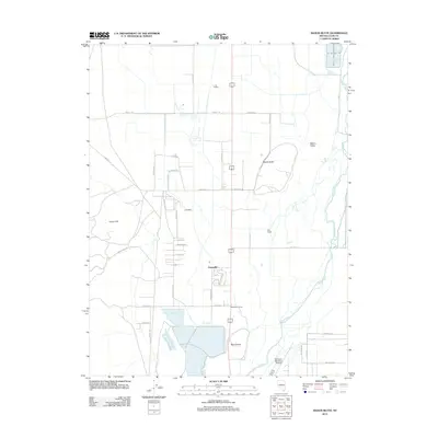
2011 Map of Mason Butte
USGS Topo · Published 2011About this map
Mason Valley is defined by the winding course of the Walker River as it flows northward through the heart of Lyon County. By the early 21st century, this landscape represents a complex blend of agricultural tradition and modern infrastructure. The presence of the L - M Feedlot and numerous ranches like Poli Ranch underscores the area's continued reliance on the valley's fertile corridor. Small residential clusters and crossroads, such as Greenville, Campbell, and McGowan Corner, anchor the local community between the prominent heights of Mason Butte and McLeod Hill. To the south, the Yerington Municipal Airport serves as a vital transportation link, while the Fort Churchill Cooling Ponds in the northeast corner highlight the intersection of water resources and utility infrastructure in the Nevada desert.
Find a feature on this map
40 named features on this map. Tap any name to fly to it.
Don’t see what you’re looking for? This feature index may not catch every label — zoom into the map to look around manually.
Map Details
Editions of this 2011 Mason Butte Map
This is the sole edition of this map. No revisions or reprints were ever made.
Other maps of this area

1891 · Wabuska
USGS Topo · 1:125,000

1891 · Wellington
USGS Topo · 1:125,000

1893 · Wellington
USGS Topo · 1:125,000

1894 · Wabuska
USGS Topo · 1:125,000

1948 · Walker Lake
USGS Topo · 1:250,000

1957 · Walker Lake
USGS Topo · 1:250,000

1957 · Wellington
USGS Topo · 1:62,500

1957 · Como
USGS Topo · 1:62,500

1957 · Wabuska
USGS Topo · 1:62,500

1957 · Yerington
USGS Topo · 1:62,500