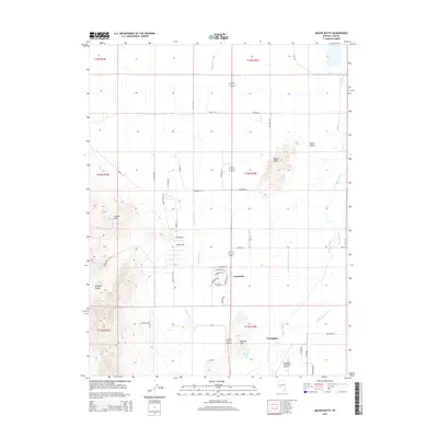
2014 Map of Mason Butte
USGS Topo · Published 2014About this map
Greenville and the northern outskirts of Yerington anchor this landscape where the desert floor meets the rising peaks of the Singatse Range. The transition from the alluvial Mason Valley to the rocky heights of Carson Hill and McLeod Hill highlights the complex topography of Lyon County. Water management is the central theme here, evidenced by an intricate network of irrigation channels including the Spragg-Alcorn-Bewley Ditch, Sand Ridge Ditch, and Wabuska Drain, all supporting agriculture in the arid environment. These man-made features weave around the natural course of the Walker River. Local infrastructure is represented by the Yerington Municipal Airport and a grid of rural routes such as Dye Ranch Rd and Miller Ln, illustrating how settlement patterns have adapted to the narrow fertile corridors between the Great Basin ranges.
Find a feature on this map
52 named features on this map. Tap any name to fly to it.
Don’t see what you’re looking for? This feature index may not catch every label — zoom into the map to look around manually.
Map Details
Editions of this 2014 Mason Butte Map
This is the sole edition of this map. No revisions or reprints were ever made.
Other maps of this area

1891 · Wabuska
USGS Topo · 1:125,000

1891 · Wellington
USGS Topo · 1:125,000

1893 · Wellington
USGS Topo · 1:125,000

1894 · Wabuska
USGS Topo · 1:125,000

1948 · Walker Lake
USGS Topo · 1:250,000

1957 · Walker Lake
USGS Topo · 1:250,000

1957 · Wellington
USGS Topo · 1:62,500

1957 · Como
USGS Topo · 1:62,500

1957 · Wabuska
USGS Topo · 1:62,500

1957 · Yerington
USGS Topo · 1:62,500