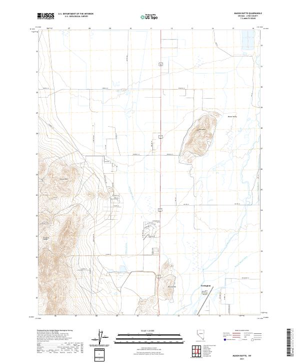
2021 Map of Mason Butte
USGS Topo · Published 2021About this map
The Mason Valley agriculture and terrain south of the state highway corridor come into sharp focus here, centered on the prominent rise of Mason Butte. This region of Lyon County is defined by a complex network of irrigation and drainage essential to desert farming, including the W Campbell Ditch, Wabuska Drain, and Nichols-Merritt Ditch. The Walker River meanders through the eastern portion of the map, while the western edge is dominated by the steep elevations of the Singatse Range and Carson Hill. Near the southern boundary, the outskirts of Yerington appear alongside the Yerington Municipal Airport. The layout of rural roads like Farrell Ln and Campbell Ln illustrates the grid-based land management and ranching homesteads that characterize this part of Nevada.
Find a feature on this map
51 named features on this map. Tap any name to fly to it.
Don’t see what you’re looking for? This feature index may not catch every label — zoom into the map to look around manually.
Map Details
Editions of this 2021 Mason Butte Map
This is the sole edition of this map. No revisions or reprints were ever made.
Other maps of this area

1891 · Wabuska
USGS Topo · 1:125,000

1891 · Wellington
USGS Topo · 1:125,000

1893 · Wellington
USGS Topo · 1:125,000

1894 · Wabuska
USGS Topo · 1:125,000

1948 · Walker Lake
USGS Topo · 1:250,000

1957 · Walker Lake
USGS Topo · 1:250,000

1957 · Wellington
USGS Topo · 1:62,500

1957 · Como
USGS Topo · 1:62,500

1957 · Wabuska
USGS Topo · 1:62,500

1957 · Yerington
USGS Topo · 1:62,500