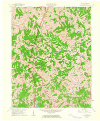
1961 Map of Mason
USGS Topo · Published 1962About this map
The Southern Railway corridor anchors this 1961 study of the Grant and Harrison county line, tracing a path through the ridge-and-valley landscape of northern Kentucky. Small rail-side communities like Mason and Blanchet serve as focal points for the surrounding rural homesteads and agricultural plots. The map reveals a high density of family-named burial grounds and country sanctuaries, such as the Sherrill Cem, O'Banion Cem, and Mt Olivet Ch, reflecting the deep-rooted genealogical heritage of the area.
Find a feature on this map
47 named features on this map. Tap any name to fly to it.
Don’t see what you’re looking for? This feature index may not catch every label — zoom into the map to look around manually.
Map Details
Editions of this 1961 Mason Map
2 editions found
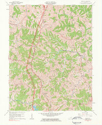
Other maps of this area

1929 · Cynthiana
USGS Topo · 1:48,000

1930 · Falmouth
USGS Topo · 1:48,000

1934 · Cynthiana
USGS Topo · 1:62,500

1936 · Falmouth
USGS Topo · 1:62,500

1939 · Sadieville
USGS Topo · 1:62,500

1950 · Mason
USGS Topo · 1:24,000

1950 · Elliston
USGS Topo · 1:24,000

1950 · Williamstown
USGS Topo · 1:24,000

1950 · Lawrenceville
USGS Topo · 1:24,000

1953 · Sadieville
USGS Topo · 1:24,000