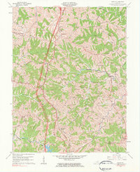
1961 Map of Mason
USGS Topo · Published 1984About this map
The Southern railway and the newly established Interstate 75 corridor cut through the undulating ridges of Grant County, creating a central transportation spine for this rural landscape. This 1961 revision captures the transition as high-speed transit began to parallel the historic route of U.S. 25, passing through small communities like Mason and Blanchet. The map is particularly dense with genealogical markers, documenting numerous family burial grounds such as Ackman Cem, Sheriff Cem, and Lawrence Cem that are tucked away near the headwaters of Grassy Run and Musselman Creek. Local social life is anchored by country churches including Mt Olivet Ch and Shiloh Ch, alongside the Mason Sch. In the eastern portion, the terrain slopes toward the South Fork Licking River, where the settlement of Cordova and Camp Northward sit amidst a complex network of creeks and named ridges like Simpson Ridge.
Find a feature on this map
44 named features on this map. Tap any name to fly to it.
Don’t see what you’re looking for? This feature index may not catch every label — zoom into the map to look around manually.
Map Details
Editions of this 1961 Mason Map
2 editions found
Other maps of this area

1929 · Cynthiana
USGS Topo · 1:48,000

1930 · Falmouth
USGS Topo · 1:48,000

1934 · Cynthiana
USGS Topo · 1:62,500

1936 · Falmouth
USGS Topo · 1:62,500

1939 · Sadieville
USGS Topo · 1:62,500

1950 · Mason
USGS Topo · 1:24,000

1950 · Elliston
USGS Topo · 1:24,000

1950 · Williamstown
USGS Topo · 1:24,000

1950 · Lawrenceville
USGS Topo · 1:24,000

1953 · Sadieville
USGS Topo · 1:24,000