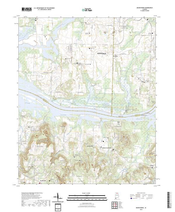
2024 Map of Mason Ridge
USGS Topo · Published 2024About this map
The Tennessee River bisects this landscape where the borders of Limestone, Madison, and Morgan counties converge. To the north, the modern infrastructure of the Huntsville International Airport Carl T Jones Field and the riverside town of Triana stand in contrast to the preserved wetlands of the Wheeler National Wildlife Refuge. The map provides a detailed look at rural community life through a high density of family burial grounds and small churches, such as the New Hope Community Church Number 2 and the New Friendship Cem.
Find a feature on this map
147 named features on this map. Tap any name to fly to it.
Don’t see what you’re looking for? This feature index may not catch every label — zoom into the map to look around manually.
Map Details
Editions of this 2024 Mason Ridge Map
This is the sole edition of this map. No revisions or reprints were ever made.
Other maps of this area

1888 · Cullman
USGS Topo · 1:125,000

1888 · Huntsville
USGS Topo · 1:125,000

1892 · Cullman
USGS Topo · 1:125,000

1892 · Huntsville
USGS Topo · 1:125,000

1936 · Triana
USGS Topo · 1:24,000

1936 · Madison
USGS Topo · 1:24,000

1936 · Hartselle
USGS Topo · 1:24,000

1936 · Decatur
USGS Topo · 1:24,000

1936 · Somerville
USGS Topo · 1:24,000

1936 · Center Grove
USGS Topo · 1:24,000