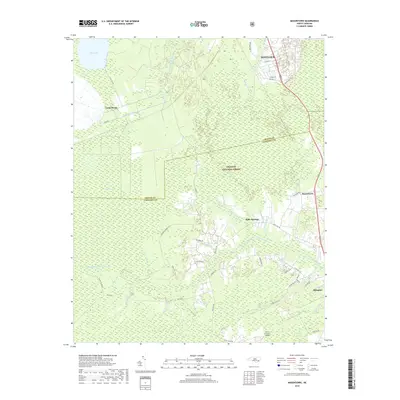
2019 Map of Masontown
USGS Topo · Published 2019About this map
Croatan National Forest dominates the interior of this coastal plain landscape, where the headwaters of several significant drainage systems converge. The map illustrates a complex hydrologic network including the Northwest Prong Newport River and the Southwest Prong Slocum Cr, which move through the densely vegetated Lakes Pocosin. This wetland environment is further defined by a series of man-made channels like N Canal, Middle Canal, and E Canal that radiate from Little Lake near Camp Bryan, indicating historical attempts to manage water levels in these pocosin lands.
Find a feature on this map
58 named features on this map. Tap any name to fly to it.
Don’t see what you’re looking for? This feature index may not catch every label — zoom into the map to look around manually.
Map Details
Editions of this 2019 Masontown Map
This is the sole edition of this map. No revisions or reprints were ever made.
Other maps of this area

1942 · Maysville
USGS Topo · 1:62,500

1942 · Swansboro
USGS Topo · 1:62,500

1948 · Maysville
USGS Topo · 1:62,500

1948 · Swansboro
USGS Topo · 1:62,500

1949 · Havelock
USGS Topo · 1:24,000

1949 · Newport
USGS Topo · 1:24,000

1949 · Salter Path
USGS Topo · 1:24,000

1949 · Mansfield
USGS Topo · 1:24,000

1949 · Cherry Point
USGS Topo · 1:24,000

1949 · Masontown
USGS Topo · 1:24,000