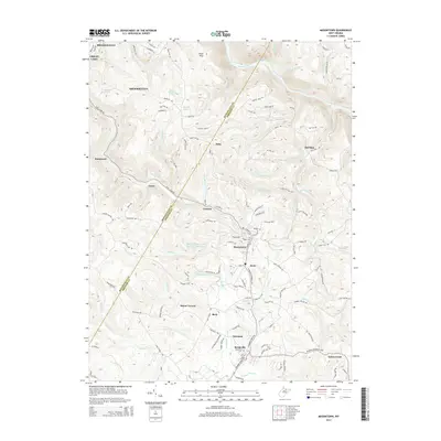
2014 Map of Masontown
USGS Topo · Published 2014About this map
Deckers Cr carves through the heart of Preston County, defining the corridor for industrial and residential settlements that thrived during the early 21st century. The map illustrates a landscape of established communities including Masontown, Reedsville, and Brookhaven, while also highlighting essential rural infrastructure like the Town of Masontown Water Supply D Lake. Along the northern edge, the Cheat River passes through Beaverhole, overlooked by the prominent high point at Cheat View. Local history and genealogy are well-represented by long-standing landmarks such as Sturgis Church, Zinn Chapel, and the Reedsville Cem. The survey captures the intricate network of secondary roads, like Earl L Core Rd and Kingwood Pike, which connect various smaller locales such as Greer, Rohr, and Bretz, illustrating the persistent settlement patterns in this part of West Virginia.
Find a feature on this map
127 named features on this map. Tap any name to fly to it.
Don’t see what you’re looking for? This feature index may not catch every label — zoom into the map to look around manually.
Map Details
Editions of this 2014 Masontown Map
This is the sole edition of this map. No revisions or reprints were ever made.
Other maps of this area

1886 · St. George
USGS Topo · 1:125,000

1891 · St. George
USGS Topo · 1:125,000

1902 · Morgantown
USGS Topo · 1:62,500

1904 · Bruceton
USGS Topo · 1:62,500

1907 · Thornton
USGS Topo · 1:62,500

1907 · Kingwood
USGS Topo · 1:62,500

1925 · Kingwood
USGS Topo · 1:62,500

1925 · Morgantown
USGS Topo · 1:62,500

1926 · Thornton
USGS Topo · 1:62,500

1926 · Bruceton
USGS Topo · 1:62,500