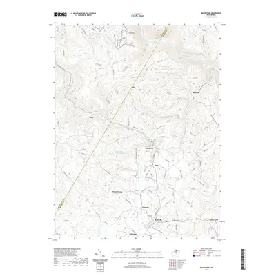
2019 Map of Masontown
USGS Topo · Published 2019About this map
The Arthurdale community and the industrial corridor of the Deckers Creek Rail-Trail define this West Virginia landscape where Preston Co meets Monongalia Co. This terrain is deeply etched by the Cheat River and Deckers Cr, supporting a string of settlements including Masontown, Reedsville, and Bretz. The map documents a complex mix of historic infrastructure and natural features, from the Miller Mine and the Town of Masontown Water Supply Lake to family-named landmarks like Dunn Cemetery and Sturgis Church. Significant topographical features such as Beaverhole and the Greens Run Long Hollow emphasize the steep relief characteristic of the region. The map preserves the modern state of local transit and land use, showing how old industrial routes have evolved into recreational paths while maintaining the core settlement patterns of the local mountain towns.
Find a feature on this map
131 named features on this map. Tap any name to fly to it.
Don’t see what you’re looking for? This feature index may not catch every label — zoom into the map to look around manually.
Map Details
Editions of this 2019 Masontown Map
This is the sole edition of this map. No revisions or reprints were ever made.
Other maps of this area

1886 · St. George
USGS Topo · 1:125,000

1891 · St. George
USGS Topo · 1:125,000

1902 · Morgantown
USGS Topo · 1:62,500

1904 · Bruceton
USGS Topo · 1:62,500

1907 · Thornton
USGS Topo · 1:62,500

1907 · Kingwood
USGS Topo · 1:62,500

1925 · Kingwood
USGS Topo · 1:62,500

1925 · Morgantown
USGS Topo · 1:62,500

1926 · Thornton
USGS Topo · 1:62,500

1926 · Bruceton
USGS Topo · 1:62,500