1973 Map of Masonville
USGS Topo · Published 1977About this map
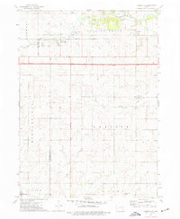
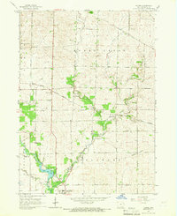
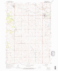
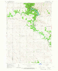
Masonville serves as the primary settlement on this landscape, positioned along the Illinois Central Gulf railroad line. The map captures a largely agricultural region spanning the border of Buchanan and Delaware counties, where a network of watercourses including Coffins Creek, Silver Creek, and Sand Creek dictates the drainage patterns across several townships. The presence of multiple cemeteries, such as Greenwood Cem and St Mary Cem, alongside the Prairie Center Community Hall, suggests a well-established rural social fabric and provides specific points of interest for genealogical research.
Find a feature on this map
29 named features on this map. Tap any name to fly to it.
Don’t see what you’re looking for? This feature index may not catch every label — zoom into the map to look around manually.
Map Details
Editions of this 1973 Masonville Map
This is the sole edition of this map. No revisions or reprints were ever made.
Other maps of this area

1900 · Anamosa
USGS Topo · 1:125,000

1901 · Oelwein
USGS Topo · 1:125,000

1902 · Elkader
USGS Topo · 1:125,000

1903 · Winthrop
USGS Topo · 1:125,000

1959 · Dubuque
USGS Topo · 1:250,000

1961 · Dubuque
USGS Topo · 1:250,000

1962 · Dubuque
USGS Topo · 1:250,000
1965 · Thorpe
USGS Topo · 1:24,000
1965 · Lamont
USGS Topo · 1:24,000
1965 · Dundee
USGS Topo · 1:24,000