
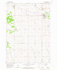
1965 Map of Lamont
USGS Topo · Published 1967About this map
Lamont and Aurora anchor this mid-1960s survey of eastern Iowa, where the landscape is defined by the intersection of the Chicago Great Western railroad and several winding watercourses. The town of Lamont is situated along the South Fork Maquoketa River, while Aurora lies near the headwaters of the East Branch Buffalo Creek. The map provides a detailed look at the rural township boundaries of Buffalo, Madison, Byron, and Fremont, illustrating a dense pattern of farmsteads and sections.
Find a feature on this map
18 named features on this map. Tap any name to fly to it.
Don’t see what you’re looking for? This feature index may not catch every label — zoom into the map to look around manually.
Map Details
Editions of this 1965 Lamont Map
2 editions found
Other maps of this area

1901 · Oelwein
USGS Topo · 1:125,000

1903 · Winthrop
USGS Topo · 1:125,000

1959 · Dubuque
USGS Topo · 1:250,000

1961 · Dubuque
USGS Topo · 1:250,000

1962 · Dubuque
USGS Topo · 1:250,000

1965 · Strawberry Point
USGS Topo · 1:24,000

1965 · Arlington
USGS Topo · 1:24,000

1965 · Dundee
USGS Topo · 1:24,000
1973 · Quasqueton
USGS Topo · 1:24,000
1973 · Winthrop
USGS Topo · 1:24,000