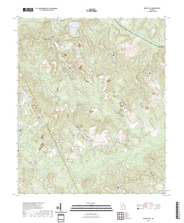
2024 Map of Massey Hill
USGS Topo · Published 2024About this map
Massey Hill and the small settlement of Clayfields define the upland landscape of this contemporary survey of the Twiggs and Wilkinson county line. The terrain is deeply carved by a network of waterways, most notably Big Sandy Creek and Clear Creek, which drain a region heavily marked by local kaolin mining interests, as evidenced by Kaolin Rd and Griffin Mine St. Family history and genealogy are well-represented by a dense collection of small burial sites, including the Augustus Fountain Family Cem, McArthur-Robinson Cem, and Holloways Hatfield Cem. This modern record reveals how historical land-use patterns, from isolated family cemeteries to industrial roads like Tin Top Rd, persist in central Georgia’s rural landscape.
Find a feature on this map
52 named features on this map. Tap any name to fly to it.
Don’t see what you’re looking for? This feature index may not catch every label — zoom into the map to look around manually.
Map Details
Editions of this 2024 Massey Hill Map
This is the sole edition of this map. No revisions or reprints were ever made.
Other maps of this area

1916 · Irwinton
USGS Topo · 1:62,500

1920 · Irwinton
USGS Topo · 1:62,500

1956 · Gordon
USGS Topo · 1:62,500

1956 · Jeffersonville
USGS Topo · 1:62,500

1957 · Macon
USGS Topo · 1:250,000

1958 · Macon
USGS Topo · 1:250,000

1964 · Macon
USGS Topo · 1:250,000
1973 · Gordon
USGS Topo · 1:24,000

1973 · Massey Hill
USGS Topo · 1:24,000
1973 · Napier Pond
USGS Topo · 1:24,000