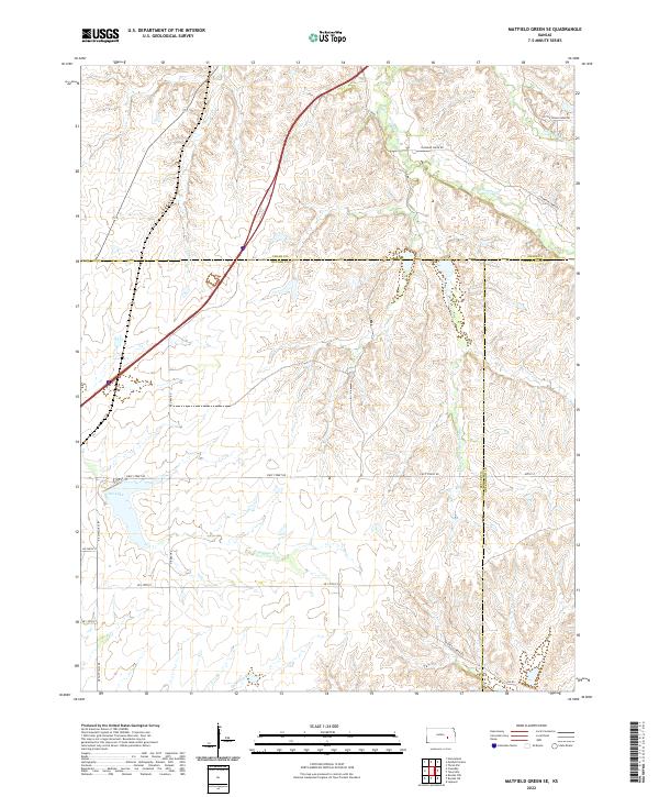
2022 Map of Matfield Green SE
USGS Topo · Published 2022About this map
The S Fork Cottonwood River and Walnut River drain this portion of the Kansas Flint Hills, a landscape defined by its persistent prairie and ranching heritage. Located where Butler, Chase, and Greenwood counties converge, the terrain is characterized by a dense network of creek systems including Mercer Cr, Thurman Cr, and Cat Cr. The presence of Fox Lake and several smaller water bodies indicates a managed water system designed to support livestock in these high pastures. A sparse network of unpaved roads like NE Flinthills Rd and NE Battle Creek Rd provides access to remote sections of the townships, following the natural contours of the ridges and valleys. The map illustrates a contemporary rural environment where the large-scale cattle operations of the past continue to shape the sparse settlement patterns and land use in this specific corner of the Tallgrass Prairie region.
Find a feature on this map
26 named features on this map. Tap any name to fly to it.
Don’t see what you’re looking for? This feature index may not catch every label — zoom into the map to look around manually.
Map Details
Editions of this 2022 Matfield Green SE Map
This is the sole edition of this map. No revisions or reprints were ever made.
Other maps of this area

1885 · Eureka
USGS Topo · 1:125,000

1888 · Emporia
USGS Topo · 1:125,000

1888 · Eureka
USGS Topo · 1:125,000

1888 · Eldorado
USGS Topo · 1:125,000

1894 · Emporia
USGS Topo · 1:125,000

1894 · Eureka
USGS Topo · 1:125,000

1898 · Cottonwood Falls
USGS Topo · 1:125,000

1955 · Wichita
USGS Topo · 1:250,000

1955 · Hutchinson
USGS Topo · 1:250,000

1958 · Wichita
USGS Topo · 1:250,000