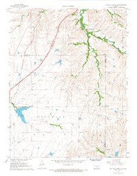
1967 Map of Matfield Green SE
USGS Topo · Published 1968About this map
The Old Indian Treaty Boundary carves a straight vertical line through this landscape, marking a historical division in the terrain of Sycamore and Salem. In the late 1960s, the Kansas Turnpike (Toll Road) and the Atchison Topeka and Santa Fe railroad run nearly parallel through the western portion of the sheet, reflecting the area's role as a major transportation corridor. The Matfield Green Service Facility sits as a lonely hub of activity along the toll road, while the small settlement of Thurman is positioned near the winding South Fork Cottonwood River. The map reveals a mix of utility and nature, from the Compressor Sta and Landing Strip to the significant waters of Fox Lake and Little Cedar Creek. This region, where Chase Co, Butler Co, and Greenwood Co meet, is defined by its transit networks and the legacy of early land treaties.
Find a feature on this map
21 named features on this map. Tap any name to fly to it.
Don’t see what you’re looking for? This feature index may not catch every label — zoom into the map to look around manually.
Map Details
Editions of this 1967 Matfield Green SE Map
This is the sole edition of this map. No revisions or reprints were ever made.
Other maps of this area

1885 · Eureka
USGS Topo · 1:125,000

1888 · Emporia
USGS Topo · 1:125,000

1888 · Eureka
USGS Topo · 1:125,000

1888 · Eldorado
USGS Topo · 1:125,000

1894 · Emporia
USGS Topo · 1:125,000

1894 · Eureka
USGS Topo · 1:125,000

1898 · Cottonwood Falls
USGS Topo · 1:125,000

1955 · Wichita
USGS Topo · 1:250,000

1955 · Hutchinson
USGS Topo · 1:250,000

1958 · Wichita
USGS Topo · 1:250,000