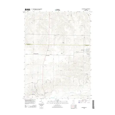
2015 Map of Matherville
USGS Topo · Published 2015About this map
Preemption and Sherrard anchor this portion of the northern Illinois landscape where the Edwards River meanders across the southern edge of the survey. The terrain is notably etched by the dendritic drainage patterns of Camp Cr, Coal Cr, and Mill Cr, which create a complex network of ridges and ravines between the primary agricultural uplands. This 2015 map preserves a record of local social and family history through its numerous burial grounds, including the Schoening Family Cem, Quaker Cem, and the Cable Village Cem.
Find a feature on this map
47 named features on this map. Tap any name to fly to it.
Don’t see what you’re looking for? This feature index may not catch every label — zoom into the map to look around manually.
Map Details
Editions of this 2015 Matherville Map
This is the sole edition of this map. No revisions or reprints were ever made.
Other maps of this area

1912 · Milan
USGS Topo · 1:62,500

1923 · Alexis
USGS Topo · 1:62,500

1925 · Alexis
USGS Topo · 1:62,500

1937 · Orion
USGS Topo · 1:62,500

1944 · Milan
USGS Topo · 1:62,500

1947 · Woodhull
USGS Topo · 1:62,500
1948 · Milan
USGS Topo · 1:24,000

1949 · Coal Valley
USGS Topo · 1:24,000

1950 · Milan
USGS Topo · 1:24,000
1953 · Coal Valley
USGS Topo · 1:24,000