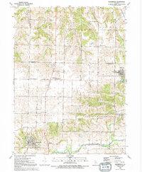
1991 Map of Matherville
USGS Topo · Published 1992About this map
The coal-mining heritage of Mercer County is evident in the layout of Matherville, a village established around the turn of the 20th century to serve local shafts. This late-century survey, based on aerial photography from 1986, details the transition of the landscape from an intensive mining hub into a primarily agricultural and rural residential region. The village of Sherrard sits near the eastern edge of the sheet, connected to the surrounding countryside by historical corridors like Knoxville Road and Ridge Road.
Find a feature on this map
15 named features on this map. Tap any name to fly to it.
Don’t see what you’re looking for? This feature index may not catch every label — zoom into the map to look around manually.
Map Details
Editions of this 1991 Matherville Map
This is the sole edition of this map. No revisions or reprints were ever made.
Other maps of this area

1912 · Milan
USGS Topo · 1:62,500

1923 · Alexis
USGS Topo · 1:62,500

1925 · Alexis
USGS Topo · 1:62,500

1937 · Orion
USGS Topo · 1:62,500

1944 · Milan
USGS Topo · 1:62,500

1947 · Woodhull
USGS Topo · 1:62,500
1948 · Milan
USGS Topo · 1:24,000

1949 · Coal Valley
USGS Topo · 1:24,000

1950 · Milan
USGS Topo · 1:24,000
1953 · Coal Valley
USGS Topo · 1:24,000