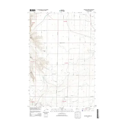
2014 Map of Mathews Corner
USGS Topo · Published 2014About this map
Mathews Corner serves as the central point of this Franklin County landscape, where the agricultural grid meets the distinct topographic breaks of the Columbia Basin. The map is defined by a series of significant drainage features, most notably the Ringold Wasteway in the northwest and a succession of deep cuts including Parsons Canyon, Baxter Canyon, and Rankin Canyon. These landforms dictate the local road network, which follows a rigid rectangular pattern across the flatter benches before deviating to navigate the canyon rims. Key thoroughfares such as Taylor Flats Rd and Glade Rd N connect the dispersed farmsteads and rural properties that characterize the area's development. This 2014 survey documents the organized expansion of irrigation and infrastructure in a region shaped by both its unique geology and modern land management practices.
Find a feature on this map
46 named features on this map. Tap any name to fly to it.
Don’t see what you’re looking for? This feature index may not catch every label — zoom into the map to look around manually.
Map Details
Editions of this 2014 Mathews Corner Map
This is the sole edition of this map. No revisions or reprints were ever made.
Other maps of this area

1917 · Pasco
USGS Topo · 1:125,000

1924 · Hanford
USGS Topo · 1:62,500

1925 · Scooteney Lake
USGS Topo · 1:62,500

1951 · Scooteney Lake
USGS Topo · 1:62,500

1951 · Richland
USGS Topo · 1:62,500

1951 · Hanford
USGS Topo · 1:62,500

1953 · Walla Walla
USGS Topo · 1:250,000

1958 · Walla Walla
USGS Topo · 1:250,000

1965 · Mesa
USGS Topo · 1:62,500

1965 · Eltopia
USGS Topo · 1:62,500