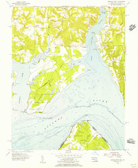
1954 Map of Mathias Point
USGS Topo · Published 1955About this map
Cedar Point Neck and Mathias Point Neck dominate this mid-century view of the riverine border between Maryland and Virginia. The landscape is defined by the broad confluence of the Port Tobacco River, Nanjemoy Creek, and the Potomac River. Significant land use is dedicated to the Blossom Point Proving Grounds, where military testing occupied the southern tip of the peninsula near Blossom Point.
Find a feature on this map
39 named features on this map. Tap any name to fly to it.
Don’t see what you’re looking for? This feature index may not catch every label — zoom into the map to look around manually.
Map Details
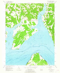
Editions of this 1954 Mathias Point Map
2 editions found
Other maps of this area

1889 · Fredericksburg
USGS Topo · 1:125,000

1890 · Mt. Vernon
USGS Topo · 1:125,000

1891 · Mt. Vernon
USGS Topo · 1:125,000

1892 · Fredericksburg
USGS Topo · 1:125,000

1892 · Brandywine
USGS Topo · 1:62,500

1894 · Wicomico
USGS Topo · 1:62,500

1894 · Fredericksburg
USGS Topo · 1:125,000

1894 · Mt. Vernon
USGS Topo · 1:125,000

1895 · Wicomico
USGS Topo · 1:62,500

1895 · Brandywine
USGS Topo · 1:62,500