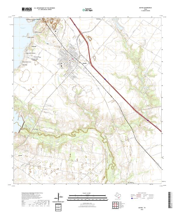
2022 Map of Mathis
USGS Topo · Published 2022About this map
Mathis serves as the regional anchor for this landscape where the Nueces River forms the natural boundary between San Patricio and Jim Wells counties. The eastern shores of Lake Corpus Christi are heavily developed with residential enclaves such as Lakeshore Gardens-Hidden Acres, Point Loma, and Lakeside, reflecting the importance of the reservoir to local settlement patterns. Away from the water, the terrain is defined by drainage systems like Sixmile Cr and Bayou Cr, which carve through the coastal plain near the historic community of San Patricio. Genealogists will find a high density of burial sites documented, including Tom Mathis Cem, Cenizo Hill Cem, and two locations for Descanso Eterno Cem. The map captures the meeting of agricultural tracts near Vahlsing and the increasing urbanization along the river's edge.
Find a feature on this map
123 named features on this map. Tap any name to fly to it.
Don’t see what you’re looking for? This feature index may not catch every label — zoom into the map to look around manually.
Map Details
Editions of this 2022 Mathis Map
This is the sole edition of this map. No revisions or reprints were ever made.
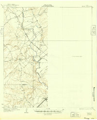
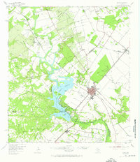
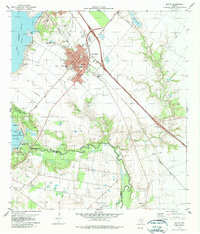
Historical Maps of Point Loma Through Time
4 maps found