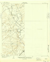
1927 Map of Mathis
USGS Topo · Published 1949About this map
The Nueces River serves as the central artery of this South Texas landscape, defining the boundaries between Live Oak, San Patricio, and Jim Wells counties. In the 1920s, the region was characterized by small rural settlements and a growing transportation network that followed the river's winding course. The San Antonio Uvade and Gulf railroad cuts through the northern portion near Mt Lucas, while the Southern Pacific (G H & S A) line anchors the southern reaches near the town of Sandia.
Find a feature on this map
26 named features on this map. Tap any name to fly to it.
Don’t see what you’re looking for? This feature index may not catch every label — zoom into the map to look around manually.
Map Details
Editions of this 1927 Mathis Map
2 editions found
Other maps of this area

1920 · Mikeska
USGS Topo · 1:125,000

1920 · San Diego
USGS Topo · 1:62,500

1925 · Oakville No. 4
USGS Topo · 1:48,000

1925 · Mathis No. 2
USGS Topo · 1:48,000

1925 · Robstown
USGS Topo · 1:62,500

1925 · Mathis No. 3
USGS Topo · 1:48,000

1927 · Mathis
USGS Topo · 1:62,500

1927 · Oakville
USGS Topo · 1:62,500

1950 · Corpus Christi
USGS Topo · 1:250,000

1953 · Crystal City
USGS Topo · 1:250,000