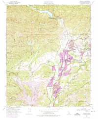
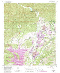
1952 Map of Matilija
USGS Topo · Published 1974About this map
Matilija Hot Springs and the surrounding canyons of the Los Padres National Forest define this landscape north of the growing Ojai Valley. By the time of this mid-century update, the newly formed Lake Casitas dominated the southwestern corner, dramatically altering the local drainage patterns of Coyote Creek and Santa Ana Creek. The map documents the post-war suburban expansion through the residential districts of Meiners Oaks, Mira Monte, and Oak View along the Ventura River. Educational and community anchors such as Villanova Sch, Happy Valley School, and the Ojai Country Club appear alongside the older agricultural and ranching legacy of Rancho Matilija and Sopers Ranch. High-elevation landmarks like Nordhoff Ridge and the Santa Ynez Mountains overlook the valley floor, while the Ex Mission San Buenaventura boundary reflects the deep historical roots of the region.
Find a feature on this map
49 named features on this map. Tap any name to fly to it.
Don’t see what you’re looking for? This feature index may not catch every label — zoom into the map to look around manually.
Map Details
Editions of this 1952 Matilija Map
5 editions found
Other maps of this area

1903 · Santa Paula
USGS Topo · 1:62,500

1903 · Mt. Pinos
USGS Topo · 1:125,000

1904 · Ventura
USGS Topo · 1:62,500

1941 · Ventura
USGS Topo · 1:62,500

1942 · Santa Paula
USGS Topo · 1:62,500

1942 · Wheeler Springs
USGS Topo · 1:24,000

1943 · Old Man Mountain
USGS Topo · 1:24,000

1943 · Lion Canyon
USGS Topo · 1:24,000

1943 · Wheeler Springs
USGS Topo · 1:24,000
1944 · Wheeler Springs
USGS Topo · 1:31,680