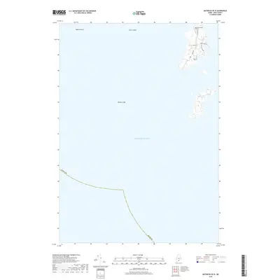
2018 Map of Matinicus OE W
USGS Topo · Published 2018About this map
Matinicus Island Airport and the local Po serve as the primary links to the mainland for this remote island community in the Atlantic Ocean. The map documents the residential and transportation layout of the island, where local travel is defined by a network of small roads and trails such as Leach Rd, Harbor Point Rd, and Burr Path. Surrounding the island, the maritime character of the region is evident in the naming of submarine features like Pigeon Ground, Foster Ledges, and Bantam Ledge, which are critical for local navigation. The land use pattern shown reflects a self-contained island economy centered around its small harbor and vital air connectivity.
Find a feature on this map
13 named features on this map. Tap any name to fly to it.
Don’t see what you’re looking for? This feature index may not catch every label — zoom into the map to look around manually.
Map Details
Editions of this 2018 Matinicus OE W Map
This is the sole edition of this map. No revisions or reprints were ever made.
Other maps of this area

1904 · Tenants Harbor
USGS Topo · 1:62,500

1906 · Matinicus
USGS Topo · 1:62,500

1906 · Tennant Harbor
USGS Topo · 1:62,500

1948 · Bath
USGS Topo · 1:250,000
1953 · Matinicus
USGS Topo · 1:24,000
1955 · Hewett Island
USGS Topo · 1:24,000

1956 · Bath
USGS Topo · 1:250,000

1957 · Bath
USGS Topo · 1:250,000

1958 · Bath
USGS Topo · 1:250,000

1963 · Bath
USGS Topo · 1:250,000
Featured Places
- Matinicus Isle, Matinicus Isle Plantation
- Matinicus Isle Plantation, ME
- Criehaven Township, ME
- Knox County, ME
- United States