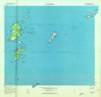
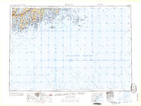
1953 Map of Matinicus
USGS Topo · Published 1959About this map
Matinicus and Ragged Island anchor this mid-century survey of the outer islands in the Atlantic Ocean off the Maine coast. The map illustrates a remote maritime community reliant on protected anchorages like Matinicus Harbor and Criehaven, where small settlements are clustered near the shore. Topographic details reveal the low-lying terrain of Wooden Ball Island and No Mans Land, while bathymetric soundings trace the hazardous shoals of Zephyr Ledges and Mackerel Ledge. A prominent U S Coast Guard Reservation is located at the southern extreme on Matinicus Rock, marked with a Light to guide mariners through the Matinicus Roads. This 1950s record provides a clear view of the island geography before modern changes, documenting family-named points and coves like Philbrook Cove and Burgess Cove that define this isolated archipelago.
Find a feature on this map
82 named features on this map. Tap any name to fly to it.
Don’t see what you’re looking for? This feature index may not catch every label — zoom into the map to look around manually.
Map Details
Editions of this 1953 Matinicus Map
4 editions found

Other maps of this area
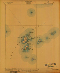
1906 · Matinicus
USGS Topo · 1:62,500

1948 · Bath
USGS Topo · 1:250,000

1956 · Bath
USGS Topo · 1:250,000

1957 · Bath
USGS Topo · 1:250,000

1958 · Bath
USGS Topo · 1:250,000

1963 · Bath
USGS Topo · 1:250,000
1965 · Bath
USGS Topo · 1:250,000

1985 · Matinicus
USGS Topo · 1:100,000

1994 · Matinicus
USGS Topo · 1:100,000
2011 · Matinicus OE NE
USGS Topo · 1:24,000
Featured Places
- Vinalhaven, ME
- Matinicus Isle Plantation, ME
- Matinicus Isle, Matinicus Isle Plantation
- Criehaven Township, ME
- Knox County, ME