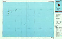
1985 Map of Matinicus
USGS Topo · Published 1985About this map
Matinicus Isle Plt and the surrounding outer islands of Knox County stand as a remote maritime outpost in the mid-1980s. This planimetric survey focuses on the isolated settlement of Matinicus and the smaller community of Criehaven on Ragged Island. The map illustrates the specialized geography of the Maine coast, where scattered ledges like East Black Ledge and Green Ledge flank essential navigation points such as Matinicus Rock. Conservation efforts are prominent here, with the Seal Island National Wildlife Refuge protecting Seal Island and its nearby waters. The distribution of small harbors and landforms, including Condon Cove and Wheaton Island, reveals a landscape defined entirely by its relationship with the Atlantic Ocean, showing the small footprints of habitation on these granite outcroppings.
Find a feature on this map
27 named features on this map. Tap any name to fly to it.
Don’t see what you’re looking for? This feature index may not catch every label — zoom into the map to look around manually.
Map Details
Editions of this 1985 Matinicus Map
This is the sole edition of this map. No revisions or reprints were ever made.
Other maps of this area

1904 · Deer Isle
USGS Topo · 1:62,500

1904 · Swan Island
USGS Topo · 1:62,500

1904 · Vinalhaven
USGS Topo · 1:62,500

1904 · Tenants Harbor
USGS Topo · 1:62,500

1904 · Rockland
USGS Topo · 1:62,500

1905 · Penobscot Bay
USGS Topo · 1:125,000

1906 · Matinicus
USGS Topo · 1:62,500

1906 · Tennant Harbor
USGS Topo · 1:62,500

1906 · Rockland
USGS Topo · 1:62,500

1941 · Rockland
USGS Topo · 1:62,500
Featured Places
- Vinalhaven, ME
- Matinicus Isle Plantation, ME
- Matinicus Isle, Matinicus Isle Plantation
- Isle au Haut, ME
- Criehaven Township, ME