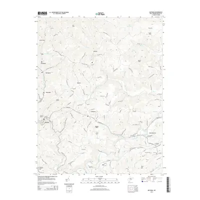
2014 Map of Matoaka
USGS Topo · Published 2014About this map
The Bluestone River and its numerous tributaries, including the Middleton Fork and Rich Creek, define the topography of this Mercer County landscape. The settlement patterns follow the winding valley floors and narrow ridges, connecting small communities like Lashmeet, Beeson, and Matoaka. Industrial activity is evident near Dott with the presence of a Slurry Impoundment, reflecting the region's long-standing connection to coal operations. Local genealogy is well-supported by numerous burial sites, such as the Saint Peters Lutheran Cemetery and the Matoaka Cemetery, alongside family-named landmarks like Browning Lambert Mountain. Near Lake Bottom, the historic Lake Shawnee sits as a notable landmark amidst the winding terrain of Periwinkle Bottom. The extensive road network, including the Old Star Mine Haul Road, illustrates how extraction and transport infrastructure have shaped the movement through these West Virginia hills.
Find a feature on this map
111 named features on this map. Tap any name to fly to it.
Don’t see what you’re looking for? This feature index may not catch every label — zoom into the map to look around manually.
Map Details
Editions of this 2014 Matoaka Map
This is the sole edition of this map. No revisions or reprints were ever made.
Other maps of this area

1887 · Pocahontas
USGS Topo · 1:125,000

1891 · Pocahontas
USGS Topo · 1:125,000

1891 · Raleigh
USGS Topo · 1:125,000

1894 · Pocahontas
USGS Topo · 1:125,000

1895 · Pocahontas
USGS Topo · 1:125,000

1897 · Raleigh
USGS Topo · 1:125,000

1902 · Raleigh
USGS Topo · 1:125,000

1909 · Pocahontas Special
USGS Topo · 1:48,000

1911 · Flattop
USGS Topo · 1:48,000

1911 · Pocahontas Special
USGS Topo · 1:62,500