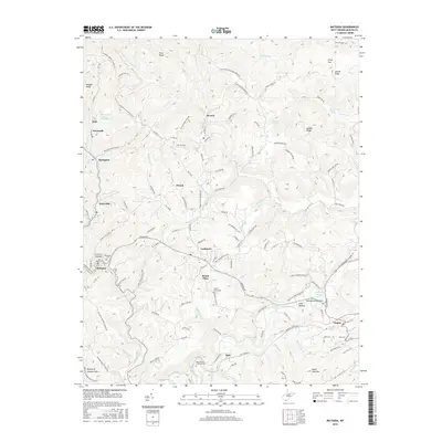
2016 Map of Matoaka
USGS Topo · Published 2016About this map
Lashmeet and Matoaka anchor this 2016 study of the West Virginia coalfields, where the industrial past is etched into the landscape via the Turkey Gap Slurry Impoundment and the winding Norfolk Southern rail line. The terrain is defined by the sharp ridges of Morgan Ridge and Stovall Ridge, separated by a dense network of watercourses like the Bluestone River and Rich Creek. Small, high-altitude settlements such as Pinoak, Beeson, and Mount Olive are connected by a mix of established roads and utilitarian paths like Old Stap Mine Haul Road and Strip Mine Road. For genealogists, the map preserves the location of family and community resting places, including the Saint Peters Lutheran Cemetery near Kale and the Ross Cemetery near Kegley. The placement of Periwinkle Bottom along the river highlights the specific pocket-valley settlement patterns characteristic of Mercer County.
Find a feature on this map
132 named features on this map. Tap any name to fly to it.
Don’t see what you’re looking for? This feature index may not catch every label — zoom into the map to look around manually.
Map Details
Editions of this 2016 Matoaka Map
This is the sole edition of this map. No revisions or reprints were ever made.
Other maps of this area

1887 · Pocahontas
USGS Topo · 1:125,000

1891 · Pocahontas
USGS Topo · 1:125,000

1891 · Raleigh
USGS Topo · 1:125,000

1894 · Pocahontas
USGS Topo · 1:125,000

1895 · Pocahontas
USGS Topo · 1:125,000

1897 · Raleigh
USGS Topo · 1:125,000

1902 · Raleigh
USGS Topo · 1:125,000

1909 · Pocahontas Special
USGS Topo · 1:48,000

1911 · Flattop
USGS Topo · 1:48,000

1911 · Pocahontas Special
USGS Topo · 1:62,500