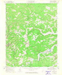
1968 Map of Matoaka
USGS Topo · Published 1971About this map
The Norfolk And Western railroad winds through the coal-bearing valleys of Mercer County, linking the active mining hubs of Matoaka and Wenonah. This late-1960s landscape is defined by the industrial footprint of numerous Strip Mines, tipples, and mine dumps that dot the ridges around Hiawatha and Springton. Between these industrial zones, small rural communities persist along the watercourses, including Lashmeet and Beeson, where local landmarks like Beeson Chapel and Rich Creek Ch anchored the social life of the region.
Find a feature on this map
63 named features on this map. Tap any name to fly to it.
Don’t see what you’re looking for? This feature index may not catch every label — zoom into the map to look around manually.
Map Details
Editions of this 1968 Matoaka Map
2 editions found
Other maps of this area

1887 · Pocahontas
USGS Topo · 1:125,000

1891 · Pocahontas
USGS Topo · 1:125,000

1891 · Raleigh
USGS Topo · 1:125,000

1894 · Pocahontas
USGS Topo · 1:125,000

1895 · Pocahontas
USGS Topo · 1:125,000

1897 · Raleigh
USGS Topo · 1:125,000

1902 · Raleigh
USGS Topo · 1:125,000

1909 · Pocahontas Special
USGS Topo · 1:48,000

1911 · Flattop
USGS Topo · 1:48,000

1911 · Pocahontas Special
USGS Topo · 1:62,500