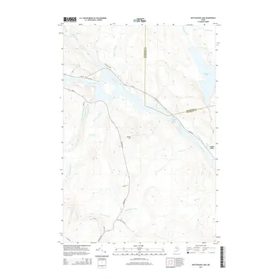
2014 Map of Mattaseunk Lake
USGS Topo · Published 2014About this map
Penobscot River and its major tributaries define this corridor of the Maine woods, where the waterway expands into the Penobscot River Reservoir before narrowing past Jordan Mills. The landscape is a network of drainage systems including Mattaseunk Stream and Salmon Stream, which flow through the timberlands east of Kimble Hill. This 2014 survey documents the modern road network essential to the local forest economy, from Medway Rd and Woodville Rd to specialized routes like Pinkham Camp Rd. The boundary between Penobscot and Aroostook counties cuts across the northeastern quadrant, marking a transition between these two northern administrative regions. Local topography is detailed from the shores of Mattaseunk Lake to the various brooks, such as Baker Brook and Rush Brook, that feed the river system.
Find a feature on this map
35 named features on this map. Tap any name to fly to it.
Don’t see what you’re looking for? This feature index may not catch every label — zoom into the map to look around manually.
Map Details
Editions of this 2014 Mattaseunk Lake Map
This is the sole edition of this map. No revisions or reprints were ever made.
Other maps of this area

1920 · Winn
USGS Topo · 1:62,500

1940 · Mattawamkeag
USGS Topo · 1:62,500

1942 · Lincoln
USGS Topo · 1:62,500

1942 · Mattawamkeag
USGS Topo · 1:62,500

1951 · Millinocket
USGS Topo · 1:62,500

1954 · Millinocket
USGS Topo · 1:250,000

1957 · Lincoln
USGS Topo · 1:62,500

1958 · Millinocket
USGS Topo · 1:250,000

1960 · Millinocket
USGS Topo · 1:250,000
1960 · Winn
USGS Topo · 1:62,500