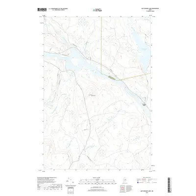
2018 Map of Mattaseunk Lake
USGS Topo · Published 2018About this map
The Penobscot River winds through this northern Maine landscape, serving as the historical boundary between Aroostook Co and Penobscot Co. The settlement of Jordan Mills sits on the eastern bank of the river, where the terrain is defined by a dense network of tributaries including Eagle Stream and Rush Brook. To the north, the waters of Mattaseunk Lake are fed by Wyman Brook and Carlton Brook, while Kimble Hill rises as a prominent landmark in the center of the sheet.
Find a feature on this map
34 named features on this map. Tap any name to fly to it.
Don’t see what you’re looking for? This feature index may not catch every label — zoom into the map to look around manually.
Map Details
Editions of this 2018 Mattaseunk Lake Map
This is the sole edition of this map. No revisions or reprints were ever made.
Other maps of this area

1920 · Winn
USGS Topo · 1:62,500

1940 · Mattawamkeag
USGS Topo · 1:62,500

1942 · Lincoln
USGS Topo · 1:62,500

1942 · Mattawamkeag
USGS Topo · 1:62,500

1951 · Millinocket
USGS Topo · 1:62,500

1954 · Millinocket
USGS Topo · 1:250,000

1957 · Lincoln
USGS Topo · 1:62,500

1958 · Millinocket
USGS Topo · 1:250,000

1960 · Millinocket
USGS Topo · 1:250,000
1960 · Winn
USGS Topo · 1:62,500