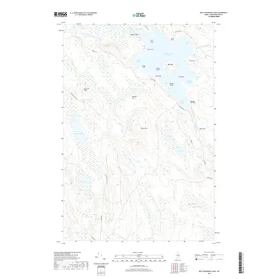
2018 Map of Mattawamkeag Lake
USGS Topo · Published 2018About this map
Mattawamkeag Lake dominates this northern Maine landscape, its intricate shoreline defined by dozens of points, coves, and islands that have likely served as landmarks for generations of woodsmen and travelers. The West Branch Mattawamkeag River flows through the northern reaches, connected to the main body of water by The Thorofare. The map reveals a naming tradition rooted in local history and lore, with evocatively named features such as Hamiltons Mistake and Devils Wall alongside family-named landmarks like Pettingill Ridge and Tapley Ridge.
Find a feature on this map
45 named features on this map. Tap any name to fly to it.
Don’t see what you’re looking for? This feature index may not catch every label — zoom into the map to look around manually.
Map Details
Editions of this 2018 Mattawamkeag Lake Map
This is the sole edition of this map. No revisions or reprints were ever made.
Other maps of this area

1937 · Smyrna Mills
USGS Topo · 1:62,500

1940 · Island Falls
USGS Topo · 1:62,500

1940 · Sherman
USGS Topo · 1:62,500

1941 · Mattawamkeag Lake
USGS Topo · 1:62,500

1942 · Island Falls
USGS Topo · 1:62,500

1942 · Sherman
USGS Topo · 1:62,500

1943 · Mattawamkeag Lake
USGS Topo · 1:62,500

1954 · Presque Isle
USGS Topo · 1:250,000

1954 · Millinocket
USGS Topo · 1:250,000

1955 · Smyrna Mills
USGS Topo · 1:62,500