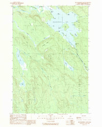
1989 Map of Mattawamkeag Lake
USGS Topo · Published 1989About this map
Mattawamkeag Lake dominates this northern landscape, its shoreline defined by deep coves and numerous islands in the late 1980s. The West Branch Mattawamkeag River flows into the lake through The Thorofare, connecting it to Upper Mattawamkeag Lake. The surrounding terrain within Island Falls and various township tracts is marked by prominent elevations like Pettingill Ridge and Tapley Ridge, which separate the primary lake basin from smaller satellite waters including Caribou Lake and Otter Lake. Local heritage is reflected in distinctive place names such as Bible Point on the riverbank and the curiously named Hamiltons Mistake near The Pocket. The survey illustrates a complex network of waterways and wetlands, such as Bush Bog, typical of the Aroostook County interior before modern development intensified.
Find a feature on this map
41 named features on this map. Tap any name to fly to it.
Don’t see what you’re looking for? This feature index may not catch every label — zoom into the map to look around manually.
Map Details
Editions of this 1989 Mattawamkeag Lake Map
This is the sole edition of this map. No revisions or reprints were ever made.
Other maps of this area

1937 · Smyrna Mills
USGS Topo · 1:62,500

1940 · Island Falls
USGS Topo · 1:62,500

1940 · Sherman
USGS Topo · 1:62,500

1941 · Mattawamkeag Lake
USGS Topo · 1:62,500

1942 · Island Falls
USGS Topo · 1:62,500

1942 · Sherman
USGS Topo · 1:62,500

1943 · Mattawamkeag Lake
USGS Topo · 1:62,500

1954 · Presque Isle
USGS Topo · 1:250,000

1954 · Millinocket
USGS Topo · 1:250,000

1955 · Smyrna Mills
USGS Topo · 1:62,500