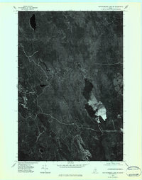
1975 Map of Mattawamkeag Lake SW
USGS Topo · Published 1984About this map
Wytopitlock Lake serves as the central focal point of this orthophotoquad in Aroostook County, providing a visual record of the northern Maine wilderness in the mid-1970s. The dense timberlands are carved by a network of waterways, including the winding Wytopitlock Stream and the Macwahoc Stream in the southwest. This aerial-derived survey reveals the intricate relationship between the region's hydrology and its forestry, where small drainages like Braley Brook and Orcutt Brook snake through the forest canopy. Unlike traditional topographic maps, this imagery-based study captures the actual texture of the vegetation and the clear-cuts of the era, offering a distinct perspective on the remote landscapes of the Mattawamkeag Lake SW quadrangle.
Find a feature on this map
5 named features on this map. Tap any name to fly to it.
Don’t see what you’re looking for? This feature index may not catch every label — zoom into the map to look around manually.
Map Details
Editions of this 1975 Mattawamkeag Lake SW Map
2 editions found
Other maps of this area

1940 · Sherman
USGS Topo · 1:62,500

1940 · Mattawamkeag
USGS Topo · 1:62,500

1941 · Mattawamkeag Lake
USGS Topo · 1:62,500

1941 · Wytopitlock
USGS Topo · 1:62,500

1942 · Mattawamkeag
USGS Topo · 1:62,500

1942 · Sherman
USGS Topo · 1:62,500

1943 · Wytopitlock
USGS Topo · 1:62,500

1943 · Mattawamkeag Lake
USGS Topo · 1:62,500

1954 · Millinocket
USGS Topo · 1:250,000

1958 · Millinocket
USGS Topo · 1:250,000