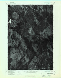
1975 Map of Mattawamkeag NE
USGS Topo · Published 1980About this map
Molunkus Lake dominates the central landscape of this Aroostook County orthophotoquad, serving as the primary drainage feature for the surrounding timberlands. In this 1975 aerial perspective, the interplay between water and forest is evident through the winding courses of Molunkus Stream and Macwahoc Stream. The map provides a raw, photographic record of land use in this part of Maine, capturing clearings and dense forest cover as they existed before subsequent decades of logging and regrowth. Unlike traditional topographic maps, this orthophotograph preserves the exact texture of the vegetation and the natural shoreline of the lake, offering a precise visual baseline for environmental historians and those studying the evolution of the Maine woods during the mid-1970s.
Find a feature on this map
3 named features on this map. Tap any name to fly to it.
Don’t see what you’re looking for? This feature index may not catch every label — zoom into the map to look around manually.
Map Details
Editions of this 1975 Mattawamkeag NE Map
This is the sole edition of this map. No revisions or reprints were ever made.
Other maps of this area

1940 · Sherman
USGS Topo · 1:62,500

1940 · Mattawamkeag
USGS Topo · 1:62,500

1941 · Mattawamkeag Lake
USGS Topo · 1:62,500

1941 · Wytopitlock
USGS Topo · 1:62,500

1942 · Mattawamkeag
USGS Topo · 1:62,500

1942 · Sherman
USGS Topo · 1:62,500

1943 · Wytopitlock
USGS Topo · 1:62,500

1943 · Mattawamkeag Lake
USGS Topo · 1:62,500

1954 · Millinocket
USGS Topo · 1:250,000

1958 · Millinocket
USGS Topo · 1:250,000
Featured Places
- Macwahoc, Macwahoc Plantation
- Macwahoc Plantation, ME
- T1 R5 WELS, ME
- Upper Molunkus Township, ME
- North Yarmouth Academy Grant Township, ME