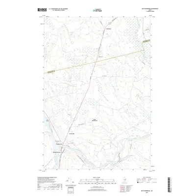
2018 Map of Mattawamkeag
USGS Topo · Published 2018About this map
Mattawamkeag sits at the confluence of the Penobscot River and the Mattawamkeag River, a landscape defined by significant water systems and low-lying wetlands. The town's historical geography is visible through clustered settlements like Meadowville and the inland Back Settlement, which are connected by a network of local roads including Houlton RD and River RD. The terrain is marked by prominent elevations such as Webb Hill and Beech Hill, which rise above a network of drainages like Sunken Bog Brook and Whitten Brook. Further north, the settlement of Molunkus lies near the county line, while to the southeast, the Gordon Falls area and the Mattawamkeag Wilderness Park indicate the area's transition into more secluded riverfront terrain. Genealogists can also locate the Mattawamkeag Cemetery situated near the main river junction.
Find a feature on this map
43 named features on this map. Tap any name to fly to it.
Don’t see what you’re looking for? This feature index may not catch every label — zoom into the map to look around manually.
Map Details
Editions of this 2018 Mattawamkeag Map
This is the sole edition of this map. No revisions or reprints were ever made.
Other maps of this area

1920 · Winn
USGS Topo · 1:62,500

1931 · Springfield
USGS Topo · 1:48,000

1934 · Springfield
USGS Topo · 1:62,500

1940 · Mattawamkeag
USGS Topo · 1:62,500

1941 · Wytopitlock
USGS Topo · 1:62,500

1942 · Mattawamkeag
USGS Topo · 1:62,500

1943 · Wytopitlock
USGS Topo · 1:62,500

1954 · Millinocket
USGS Topo · 1:250,000

1958 · Millinocket
USGS Topo · 1:250,000

1960 · Millinocket
USGS Topo · 1:250,000